
Contour surveys play a pivotal role in various industries by providing accurate information about the topography of a specific area. They are essential in fields such as construction, civil engineering, urban planning, and environmental management.
A contour survey involves mapping the elevation points of a terrain to represent its three-dimensional characteristics on a two-dimensional plane. This allows professionals to assess land features effectively and make informed decisions based on precise data.
What Are Contour Surveys?
Contour surveys are a specialised type of land survey that captures elevation data across a land parcel, creating contour lines which connect points of equal height. These lines visually depict the slope, relief, and general shape of the land surface, facilitating a clear understanding of the terrain.
The vertical distance between contour lines, known as the contour interval, indicates the steepness of slopes and natural features such as hills, valleys, and depressions.
How Contour Surveys Are Conducted
The process of conducting contour surveys involves collecting precise measurements with the use of advanced surveying equipment such as total stations, GPS technology, and digital levels. Surveyors record elevation points at regular intervals across the study area to ensure comprehensive coverage of the land’s topography.
The collected data is then processed using specialised software to generate detailed contour plans that accurately represent the terrain.
Equipment and Techniques
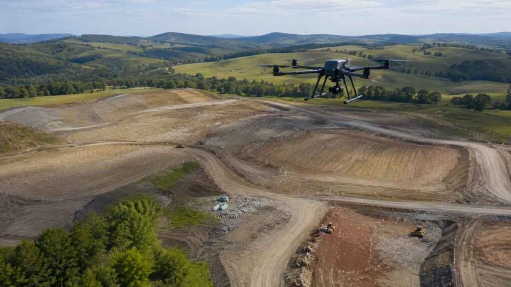
The technology utilised in contour surveys has evolved significantly, resulting in increased efficiency and accuracy. While traditional methods involved manual measurements, modern techniques employ GPS surveying, drone photogrammetry, smart systems in modern engineering and laser scanning. These technologies enable the rapid capture of large datasets with minimal human error, enhancing the reliability of the final contour maps.
Importance of Contour Surveys
Understanding the topography of a site is critical for many projects, and contour surveys provide the foundation for this understanding. The applications of contour surveys extend into various sectors, ensuring safer and more cost-effective designs and constructions.
Construction and Engineering
In construction and civil engineering, contour surveys are indispensable during the planning and design stages. They enable engineers and architects to assess the feasibility of a project, determine the volume of excavation required, and design drainage systems effectively. By understanding the natural terrain, professionals can prevent potential issues such as soil erosion, flooding, and structural instability.
Urban and Regional Planning
Urban planners rely on contour surveys to design infrastructure such as roads, bridges, and buildings that integrate seamlessly with the existing landscape. Accurate topographical data allows for optimisation of land use, promotion of sustainable development, and reduction of environmental impact.
Environmental Management
Environmental specialists use contour surveys to monitor land changes, manage watersheds, and conserve natural habitats. Detailed elevation data assists in understanding water flow patterns and soil characteristics, which are vital for preserving ecosystems and planning restoration projects.
Applications of Contour Surveys

Land Development and Subdivision
Land developers utilise contour surveys to assess the topography before subdividing a property. This ensures that each parcel is suitable for intended use and complies with local regulations. Contour plans help identify areas suitable for building, open spaces, and necessary landscaping features.
Infrastructure Projects
Large infrastructure projects such as highways, railways, and airports require comprehensive contour surveys. These surveys facilitate optimal route selection, earthworks estimation, smoother property management and identification of potential hazards, contributing to cost savings and enhanced project safety.
Agricultural Planning
Farmers and agricultural engineers employ contour surveys for land grading and irrigation planning. Contours help in managing water runoff, reducing soil erosion, and maximising the efficiency of irrigation systems, leading to improved crop yields.
Flood Risk Assessment
Flood risk management relies heavily on contour surveys to map floodplains and assess the vulnerability of areas to flooding. Authorities and engineers use this information to design levees, drainage canals, and emergency response strategies.
Benefits of Detailed Contour Plans
Detailed contour plans provide several benefits, including precision, clarity, and ease of interpretation. They allow stakeholders to visualise the landform without physically visiting the site, saving time and resources. Additionally, these plans serve as legal documents during land transactions and regulatory approvals.

Accuracy and Reliability
The precision of contour surveys leads to reduced risks in project execution by minimising unforeseen complications related to terrain. Reliable topographic data supports accurate cost estimation and resource allocation.
Time and Cost Efficiency
By providing a clear understanding of the land’s features early in the project lifecycle, contour surveys help avoid costly modifications and delays. Efficient planning based on these surveys results in smoother project implementation.
Choosing a Professional Surveyor
To obtain reliable contour surveys, it is crucial to engage experienced and qualified surveyors who understand the complexities of topographic data collection and interpretation. Professionals employ state-of-the-art equipment and adhere to industry standards to produce detailed and accurate contour plans.
Working with experts ensures that data is correctly analysed and tailored to the specific requirements of each project. This facilitates compliance with local laws and contributes to successful project outcomes.
Conclusion
Contour surveys constitute an essential component in the planning and execution of various projects across multiple sectors. Their ability to accurately represent the terrain allows for informed decision-making, risk reduction, and efficient resource use. Whether for construction, environmental management, or land development, contour surveys provide the foundational data required for effective land use that enhance business appeal.
For comprehensive and precise topographic data, consulting services specialising in contour surveys offer invaluable support to professionals and stakeholders involved in land-related projects.